Trails, Treks and Images of the Tallaganda Wilderness, Tallaganda National Park, Tallaganda State Park, Tallaganda Conservation Area
Tallaganda is thought to be the name the First People gave to the valley and mountains within about 20 miles of the rising of the Shoalhaven River. Originally the name was used for the region, but today the name is reserved for the western mountains.
The streams that feed the Shoalhaven fall through weathered bedrock into distinct valleys that have formed part of the landscape for more than 20 million years. Paths through the landscape along those waterways and connecting ridges have been travelled for time immemorial, and the area looked to as a valuable source of water, food and tools. Since early colonial times, the area has been extensively logged, although large parts are now preserved.
This page indexes Tallaganda trails (some easy, some challenging), stories and art of the area.
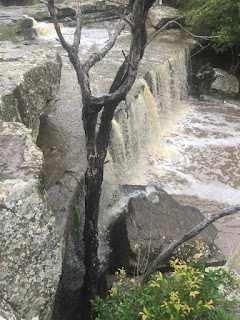
The Tallaganda is a place of many contrasts, full of small cascades and waterfalls, stunning rock capped ridges and peaks, glorious orchid displays and beautiful vistas. Snow and ice in mid winter - blisteringly hot in summer. There are plenty of easy and challenging walks to be found: the area was (and some parts still are) logged, and there are a multitude of tracks (new and old) to follow into the depth of the forests. Just below the Tallaganda are deep pools and rivers that can be swum or kayaked.
[This list is being populated as hikes are mapped.]
Images
Images, Locations and Trails
1. Images
2. Mountains (Talus) (with maps)
- Black Range Talus (Gentle 2km, 100min, 90m ascent)
- Mt Cowangerong (1362m, BOM weather tower)
- Mt Cronin Talus
- Mt Lowden Talus (Medium 6km, 140min, 350m ascent)
- Lyrebird Talus
- Mt Tumanang and Wild Cattle Flats (John Evans*)
- Mt Palerang Talus (Challenging 3km, 180min, 300m ascent)
3. Falls (public falls include maps)
- Amphitheater Falls (public)
- Coffee and Cream Falls (public)
- Galvins Creek Falls
- Harolds Cross Creek Falls (public)
- Jerrabattgulla Falls: South Forest Way (John Evans*) (public)
- Mugga (Tiger Snake) Falls
- Mulloon Creek Falls (public)
- Mulloon Creek Falls (public)
- Mountain Gully Creek Falls First Second Third (public)
- Pipe Clay Falls
- Raggeds Falls (public)
- White Wombat Falls First Second
- Yandyguinula Creek Falls (public)
4. Trails and Locations (with maps)
- Mountain Gully Creek Loops: Main Falls and Upper, Mid, Lower
- Yandyguinula Creek Source (Challenging 4.5km, 150min, 100m ascent)
- Bowerbird Falls Loop (Challenging 5.5km, 120mins, 120m ascent)
- Mt Cronin Rainforest Loop (Challenging 1.5km, 60min, 45m ascent)
- Black Range Fire Trail (Gentle 2km, 100min, 90m ascent)
- Harolds Cross Creek Falls Loop (Gentle 4km, 90min, 90m ascent)
- Fern Gully Walk (Lowden Creek) (Forestry*)
- Lowden Forest Park (Hopkins Pond & Water Wheel) (Forestry*) (Note - closed 18/7/21)
- Mulloon Creek Campground (Parks & Wildlife*)
- Jinglemoney Fire Trail: Bombay Creek (John Evans*)
- Eucalyptus Oil Still Loop (Bald Hill Fire Trail)
- Mulloon Creek Source (Challenging, 1km loop, 40mins, 35m ascent)
- Maroonhood Scramble (Easy, 200m, 40mins, 8m ascent)
- South Tallaganda Loop
- Snake Tree Fire Trail
- Upper Molonglo Trail
- Upper Ballallaba Creek
- Chinese Walls
- Hickory Road
- Sawmill Creek
- Sth Forest Way (Bush Paddock Creek)
- Rocky Pic Fire Trail
5. Rivers and Pools (nearby Tallaganda)
- Shoalhaven River Reserve
- Shoalhaven Stock Reserve
- Molonglo Gorge
Some of these resources are on other web sites including:
* John Evans - I include a couple of links to walks described by John Evans. John's blog is an inspiration to all those who enjoy walks in the Canberra Region.
*Forestry - provides very basic information to an old camp and surrounds near Lowden
*Parks and Wildlife - provides minimal information to the Mulloon Creek Campsite
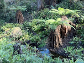
The Tallaganda is mountainous region between Canberra and the coast. It is an important water source, discharging a decent volume of water into the Molonglo (west running) and Shoalhaven (east running), in both wet and dry times. It encompasses both dry and wet sclerophyll forests (spiky eucalypts, wattles and banksias growing in low fertility soils) with pockets of rainforest. Recently, it was ravaged by fire, impacting areas of the forest differentially: some suffering great loss while other suffering little or no damage. Overall, many tall trees have survived, while around them a much reduced woodland has opened up the land (with the risk of pest species and erosion).
Research
- Tallaganda Fire: Chronology, Visions of the Apocalypse
- Regrowth and Recovery Series Creek zones: Ferns, Mosses, Lichens, Worts, Fire sculptures
- Floods 2020
Wildlife
- Birds: Boobook, Lyrebird, Bowerbird, Gang Gangs, Grey Kangaroos, Honey eater, Fantail, Thornbill, Srubwren, Fairy wren, King Parrots
- Wildflowers: Orchids List, Yandyguinula Creek Orchids, First after Fire, Dusky Fingers, Hibbertia, Stylidium (Trigger Plant)
- Insects: Funnel Web spiders
- Tallaganda Wildflower Series
Visions/Stories
- Wild Nettles (short story)
- Cooroobun Dreaming (short story)
- Tallaganda Dreaming
- Farm musings , Fall , Late Summer , Fencing , Alpaca Yards , Alpaca Birthing
- Jerrabatgully 1867 , 1882 (short stories)
- Rainbows
- Wind gifts
- The Long Tailor (collection of short stories)
Cautions
There are no rescue services here, no phone reception behind hills or in valleys, and no stores or petrol stations.
Clean shoes and cloths and cars before you come. Do not introduce weeds into the wilderness.
Wear clothing that will keep your skin safe: jeans, tucked in tightly to heavy socks can be hot but will offer protection against snakes and spiders and sunburn.
In walking through the area beware of the possibility of falling branches (this can happen in calm or windy conditions). Sometimes a tree will explode for no apparent reason.
Walking through wet areas in periods of warm weather, you will always encounter leaches. It is not a matter of simply burning one off (bring matches as a last resort) as the bite will weep for weeks and may become infected. There may be paralysis ticks.
There are all the normal poisonous snakes and spiders up here plus some. You may encounter a moving male funnelweb spider on a track - the Tallaganda has about 9 different species of funnelwebs. You will see the beautiful Alpine Copperhead (that may not move out of your way) plus plenty of Tigers and Browns. Work on the basis that each new waterfall has its own snake guardian. Bring a snake bandage and know how to use it. Keep to tracks and watch your step.
You may encounter feral pigs or hunters and dogs searching for feral pigs. They are shy and will try to avoid you. Exercise care - sneaking around might get you close to a lyrebird but will expose you to other dangers. Be prepared to dodge motor bike enthusiasts - they are a generally nice crowd who keep to their own trails and, in their own way, help keep the forest safe and paths clear (if deeper). On the road, watch out for firewood collectors and be aware that they drop cut logs onto the road from time to time.
Don't climb fences into private property.


Comments