Majors Creek Falls, Majors Creek SCA
To the east of the old gold rush town of Majors Creek is a deep escarpment, famous for an attempted robbery on the cliff face road to Araluen by a gang of bushrangers including the local Clark Gang. While the Irish brothers met their fate a century ago, the community remains divided over whether they were criminals or just high spirited kids. Less doubt is expressed about some of their contemporaries. The Hurley girls, Lucy and Caroline, proved a couple of times that they could steal the two horses tethered outside the Majors Creek police station. They would be up to the bridle path in full gallop towards Braidwood before the police stumbled out of the shack.
Historic injustice is not the only thing that divides the community - a fierce debate pits miners against orchardists with fears of contaminants from a local gold mine despoiling rich farmland. For, at the bottom of the steep ravines is the orchard region of Araluen, where Majors Creek finally joins the Duea River before plunging back into deep wilderness.
The Majors Creek/Araluen escarpment is is an area of high inaccessible waterfalls. Most (Araluen Creek and Bell Creek) are known only by accounts from miners or the sound of them crashing far below.
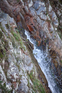
One accessible fall in this area is a long cascade of Majors Creek after it leaves the vicinity of the Majors Creek. In contrast, the long steep falls of nearby Bells Creek are best avoided and remain beyond the reach of even determined bush walkers.
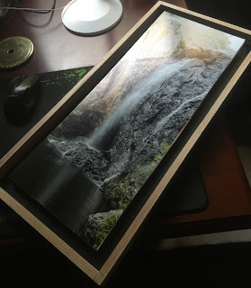
The fall is extremely variable - water flow and light can cast strange shapes into the rock wall behind the fall.
The Majors Creek Falls once boasted a Rotary lookout, but this was demolished a couple of years back. Locals get access to a vantage of the falls through scrub to the edge of a deep drop, which can be dangerously slippery after heavy rain. If you take this path, you may meet locals enjoying a walk to the falls - the folk of Majors Creek are a wonderful bunch, full of stories of their beautiful town and its history (the Australian folk singer Hannah Gillespie lives nearby). They also open their town and its old pub to an annual folk music festival, and i hope the tradition survives the Pandemic.
In spring, the bushland hosts a beautiful array of purple flags and, if you are lucky, a rare glimpse of masses of the Large Golden Moth Orchids.
Lyrebirds scrabble for insects in this area and are often heard and sometimes seen.
Location Maps
Online maps disagree about the shape of the roads and the creek (and, recently, some of the public roads seem to have been scrubbed from public maps - perhaps a good things, if inaccurate). If in doubt, call into the local pub and confirm accessibility. Proceed with caution - this is not a place to wander after rain or a cold snap. Do not attempt to drive into this area - you may never drive out.
A more detailed trace of my walk from a parking location is here.
Access to the falls is gained from Wilsons Road. Park your vehicle along the road reserve before the road dips into the Majors Creek SCA (be aware that the road provides access to locals, and should not be obstructed).
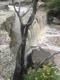
The top of the falls can be found by walking from the parking area down the road to the creek and then down the creek into the top gorge. Here you will find small falls, races and pools - and the path will require scrambling across rocks. Finally you will come to a halt when the gorge drops into a large clearing near the top of the falls which will make further descent difficult.
Return to the road and walk back up towards your parking are a little way. You will see faint tracks which will take you to the top of the steep cliffs looking down on the falls. Great caution should be exercised in this area - do not climb onto an area that slopes towards the gorge or, near the edge, that may be unstable. This is an area that changes a great deal from season to season - the ground may be grassy or it may be a tangle of thorns.
This is #3 in a series of Lost Falls of South Eastern Australia - the Index Page is here


Comments